Howden Edge
OS Grid reference- SK 187 943
Howden Edge which rises 1,787 feet (545 meres) it is the second highest point in South Yorkshire, after Margery Hill. The gritstone peak is situated in the north east of the Upper Derwent Valley area of the Peak District National Park and lies to the north east of Howden Reservoir and to the west of Sheffield.
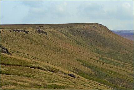
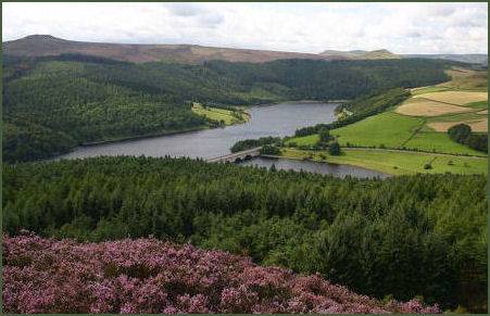
The path which runs along the edge provides superb views of the surrounding moorland. The best way to approach Howden Edge is from the spectacular Upper Derwent Valley. A deep valley surrounded by gritstone edges, it has three reservoirs, the Ladybower Reservoir (pictured above right), which is situated to the south of the valley, the centrally placed Derwent Reservoir and the Y shaped Howden Reservoir to the north.
The valley presents as an attractive mix of large stretches of water and woodland surrounded by high moorland. The valley sides are mainly clothed with larch, spruce and pine, with some remnants of old oak woodlands. Wildlife includes red grouse, mountain hare and golden plover. There are 3 car parks along the way before you reach Fairholmes Visitor centre as well as a larger one at the centre itself which is pay and display.