Rivelin Valley
OS Grid reference- SK 288 865
The River Rivelin in Sheffield, rises on the Hallam moors, to the north west of the city and joins the River Loxley at Malin Bridge. The wooded Rivelin Valley stretches for three and a half miles and includes the popular and picturesque Rivelin Valley Nature Trail which runs out towards the Peak District and was created in 1967.
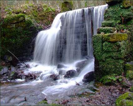
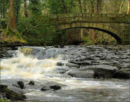
The river drops 80 metres between Rivelin Mill Bridge and Malin Bridge and was used from as far back as the fifteenth century as a power source, driving the water wheels of industries along its course. The Valley has 21 artificially created ponds, surviving from the twenty mills which once occupied the riverside. Though most of the mills and forges have not survived, the ponds which used to feed them have.
Tablets dating from the Roman era were discovered in the Rivelin Valley south of Stannington in April 1761. They were found near to the likely course of the Templeborough to Brough-on-Noe road.There have also been finds dating from the Roman period on Walkley Bank Road, which leads on to the valley bottom.
The valley provides a home for much wildlife, which is now protected by the Rivelin Valley Conservation Group, the group was formed in 1991 with the aim to encourage the effective management of wildlife habitats.
The upper part of the valley is flanked to the north by Rivelin Rocks. The rocks re-emerge three kilometres further down the valley above the Rivelin Hotel or "The Rivelin" on Tofts Lane, a former farm building which is the only pub in the rural part of the valley. The Rivelin Dams are two water storage facilities situated in the upper part of the valley and provide drinking water for the west and south-west areas of Sheffield.